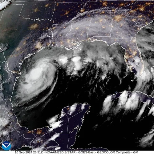
Brace yourselves, folks! Hurricane Francine is on its way and is expected to make landfall along the central Louisiana coast, bringing some seriously dangerous storm surges and powerful winds.
Francine hit hurricane status on Tuesday and is predicted to dump up to a foot of rain between Lafayette and Houma, according to the National Hurricane Center. As of Tuesday evening, the storm was hanging out about 150 miles east of the mouth of the Rio Grande and 350 miles southwest of Morgan City, Louisiana, packing sustained winds of 75 mph. It’s moving northeast at around 10 mph.
The storm is expected to bring heavy rain to Mississippi by Wednesday as it heads northward as a tropical depression, making its way up into the Mississippi Valley. By Thursday night, it could reach Memphis.
AccuWeather’s hurricane expert Alex DaSilva mentioned that dry air on Tuesday kept Francine from hitting the Gulf as a hurricane, but warned that those high Gulf water temperatures have been like “rocket fuel” for the storm.
As it moves north, Francine could bring torrential rain to Mississippi, southern Alabama, and further up into the Mississippi Valley on Wednesday. The National Weather Service also warned that a few tornadoes could pop up in Louisiana, Mississippi, Alabama, and the Florida Panhandle. Stay safe out there!